This page holds unsorted results and research material from the ‘Quest for the Secret Tunnel’ – whose purpose and funding will be familiar to its sponsors. The material is not assembled into a properly coherent narrative, nor is anything explained in depth. This is here simply for sponsors to enjoy, and to see that we’re making some progress.
Now, can it be this easy?
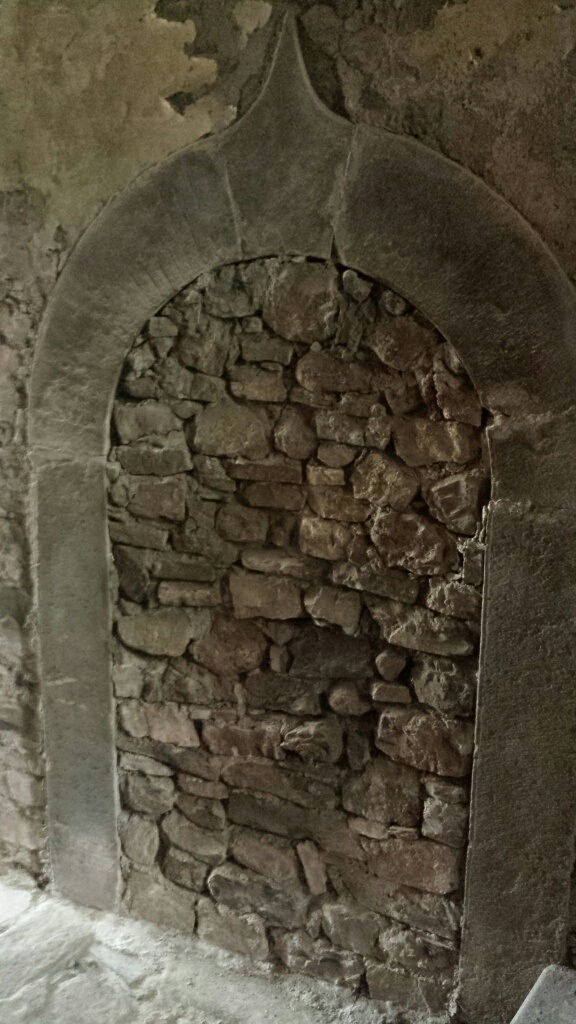
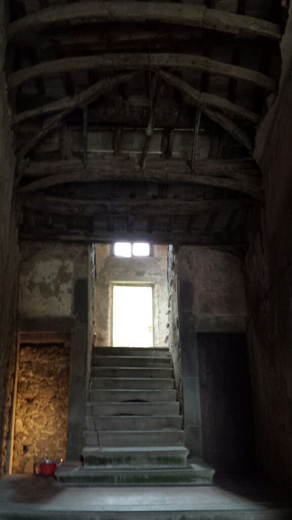
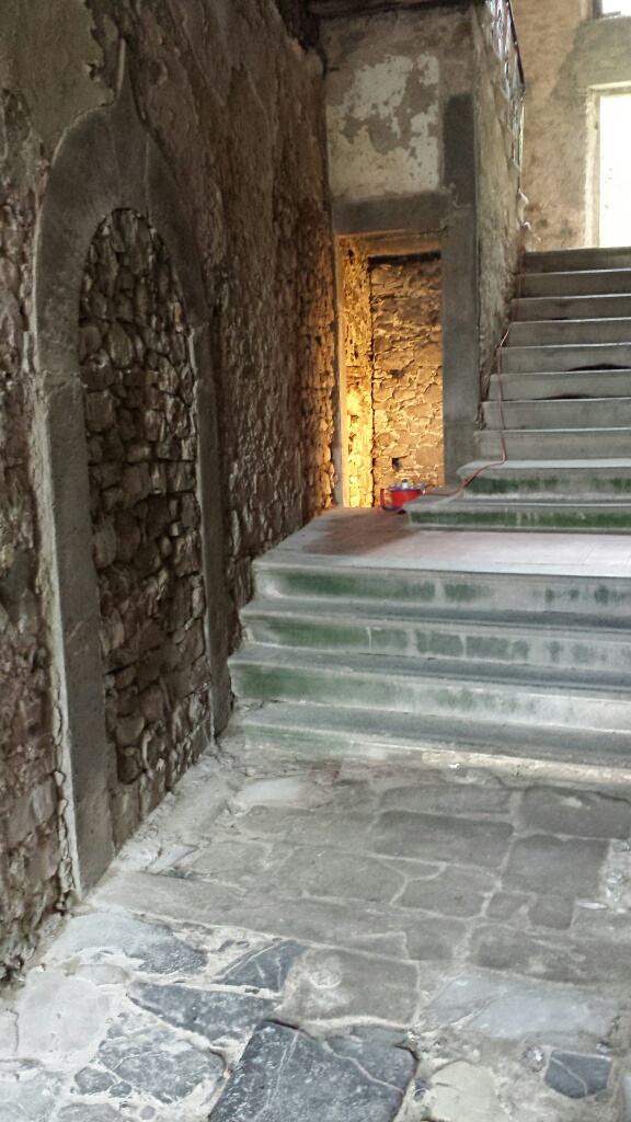
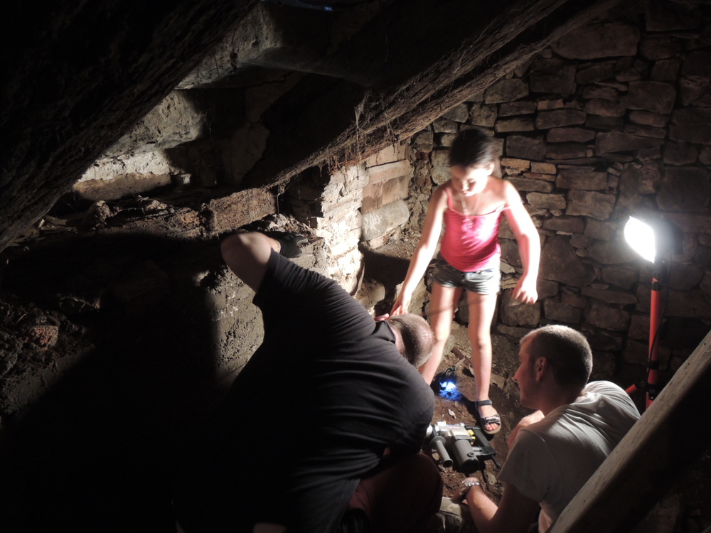
If only. The walled-up arch is ‘under the Doctor’s house’, but sadly that’s not the tunnel entrance.. In fact it was somewhere.. sotto la scala. Under the stairs. Confirmed by multiple old men pointing at the giant wall that was built to block it in (as far as I can tell) 1944.
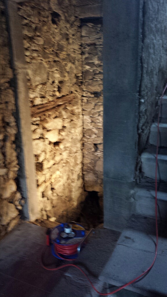
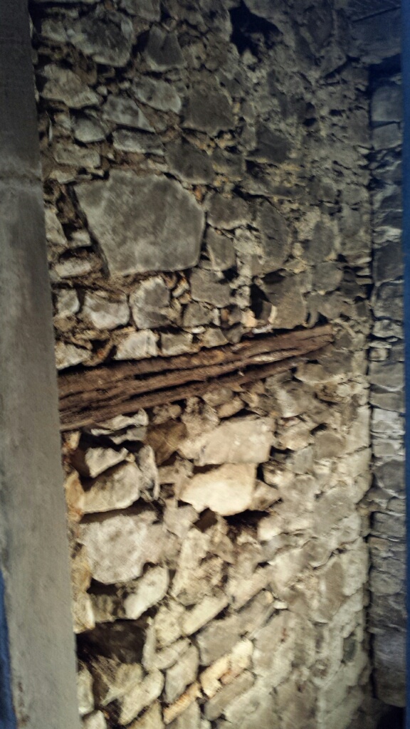
What’s this ventilation hole for?
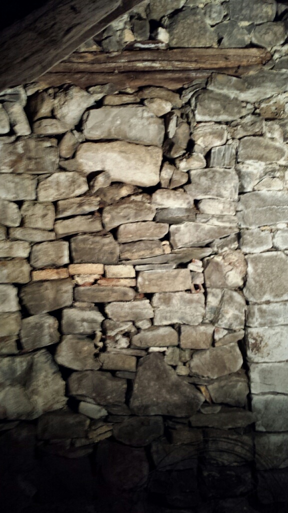
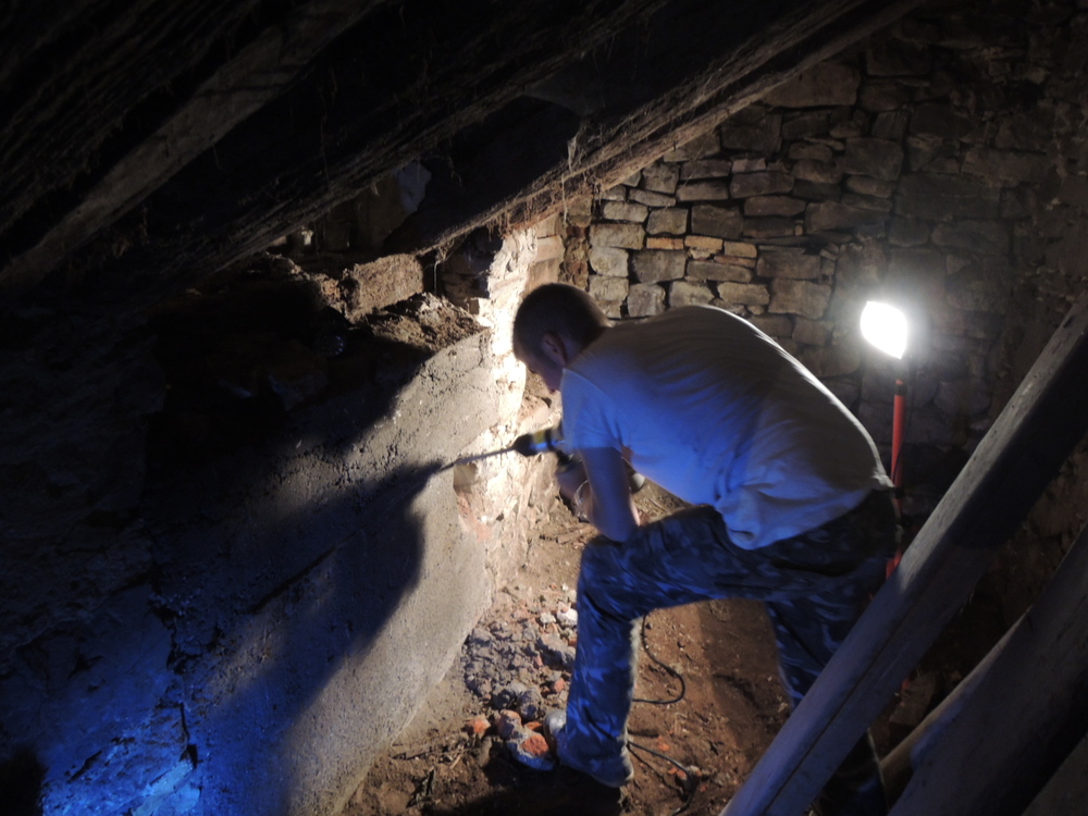
The workers..
Hmmm.. but then we got locked out. So, geophysics to the rescue!
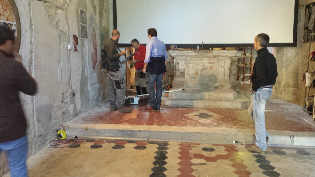
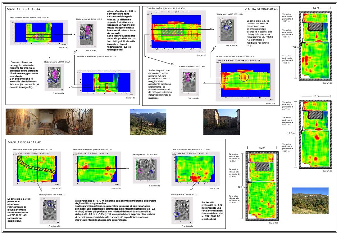
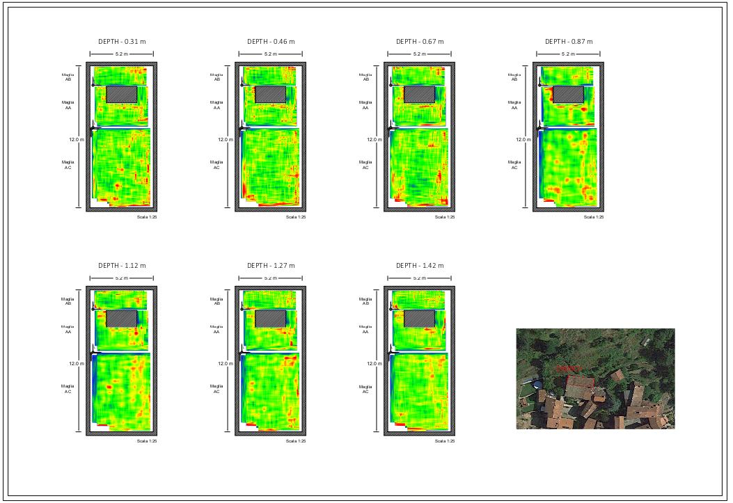
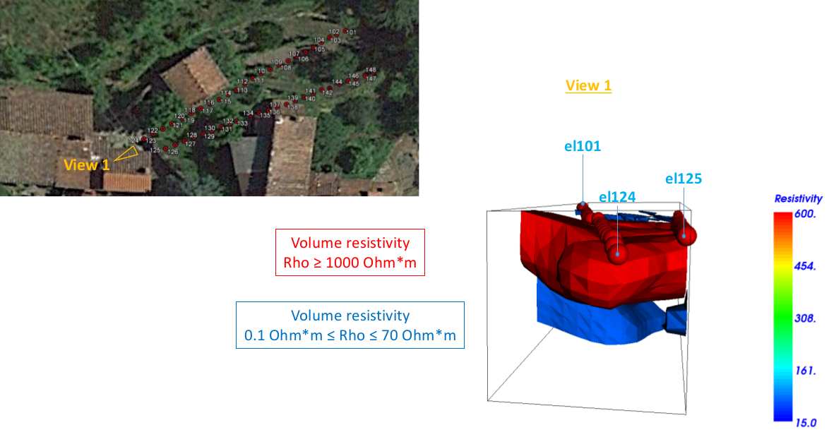
I heard a rumour – from a supposedly reputable source – that there were multiple passages (the word ‘catacombs’ was used) eventually connecting with a crypt under the TTI church. Here are the georadar results – first of all under our church and main building (click to view the full PDF):
And now 3D geoelectric tomography (resistivity vs. depth) under the TTI main building (multi-page PDF document – click the image to view).
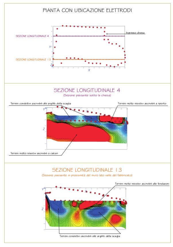
Interesting to see how the church sits on a rock shelf and the attached (presumably later) house is built on mud. No wonder there’s a giant crack running through both buildings! Note there is no crypt under the floor as imagined by my helpful informant. I have reason to believe the church floor was retiled in 1925; if any cellar-like structure existed it may be that it was filled in at that time. Nevertheless, the results are clearly extremely disappointing. I was hoping to find something like this.
Now some georadar outside, on the Doctor’s lawn and round the back of his house, plus three horizontal stripes across the terraces on the way up the hill (bottom left).
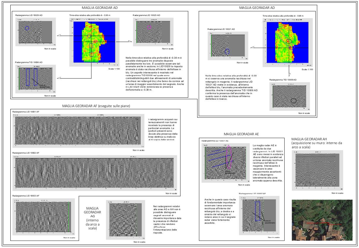
They got excited at first with the terrace ones (see e.g. the one in the bottom left corner). Perfect hyperbolic return echo, indicative of a tunnel. Except they eventually say it must be due to this electric cable:
It’s becoming clear that with the type of soil here, the georadar doesn’t have enough depth penetration (ony about 2m). What we need is more tomography. So we do a single stripe across one of the terraces (they came back to do this one for free..).
And there’s your blue blob – a ‘highly significant anomaly’ about two and half metres (8 feet) down.
Could that be the tunnel? Yes – it’s exactly where I would have thought it should be.
Can we dig down to it?
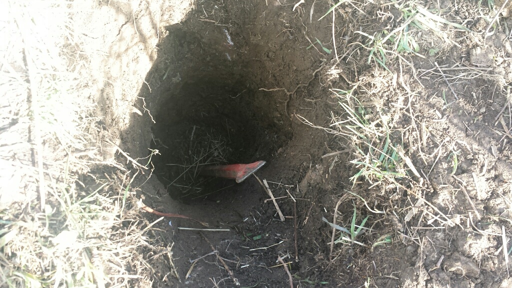
No. My red iron spike is 2m long, and it’s all the way in the hole (about two thirds of the distance to the blue anomaly) and that’s about as far as you can dig without doing a serious excavation of a hole big enough to stand in (how do you get the soil out otherwise?). This was done in the last hour of the last day of the last week we spent there in February for my daughter’s half-term holiday – so no time for anything bigger!
Hmmm.. we need to be much cleverer about this. I’m going back to Italy for Easter tomorrow – let’s see what we can do.
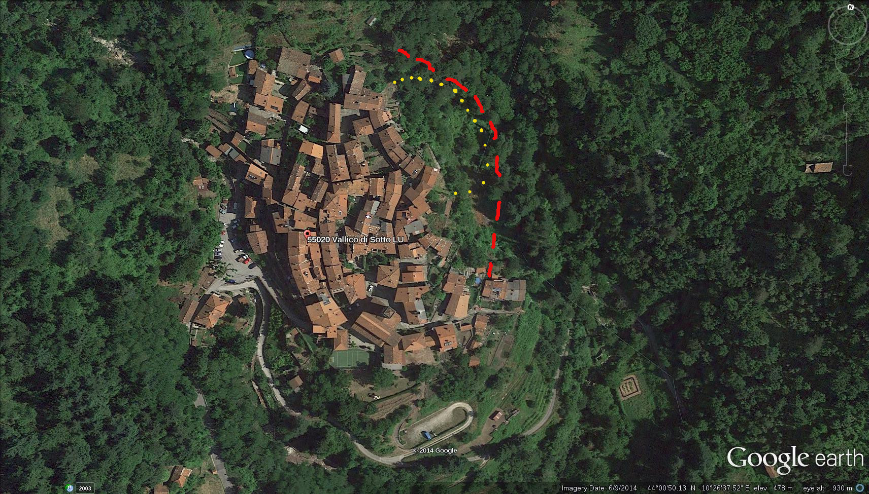
As an addendum – here’s a Google Earth of Vallico Sotto. Looking at the upper right, it seemed to me that an entire corner of the village has fallen into the ravine, and taken out not only the main wall fortication that should be there but also a possible continuation of the curved houses into a yellow circular structure. One of the geophysicists agrees; that looks like a landslide fault.
Here’s a 1954 aerial shot of the village.
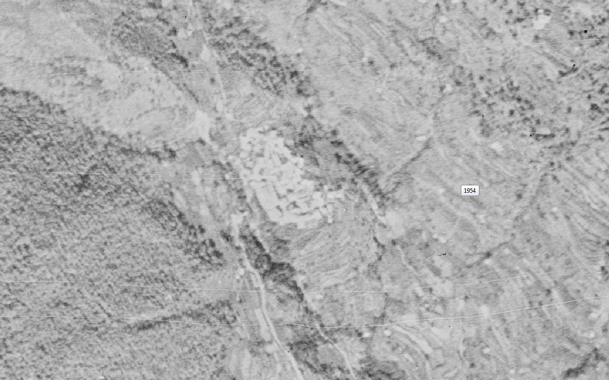
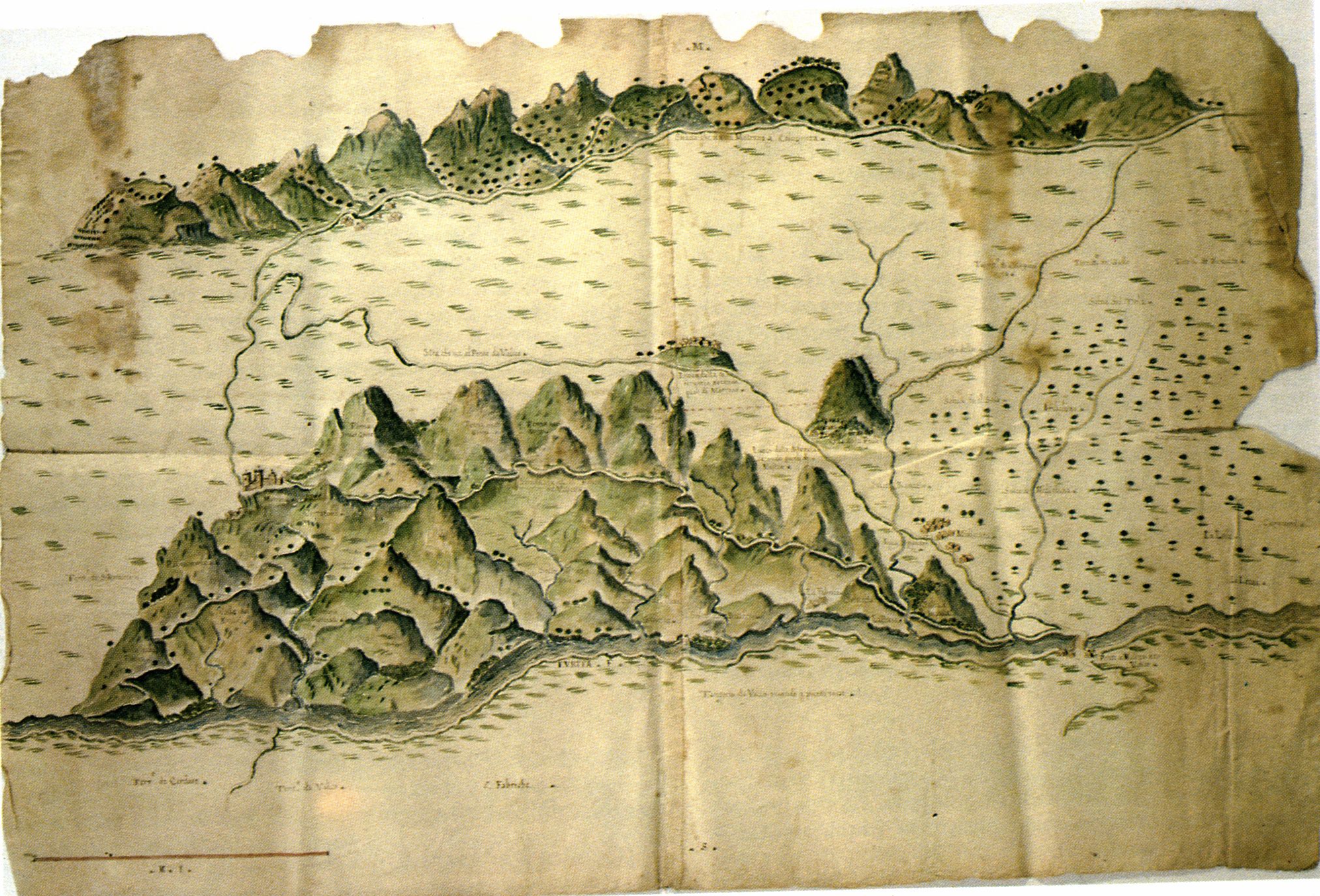
Here’s an 1894 map:
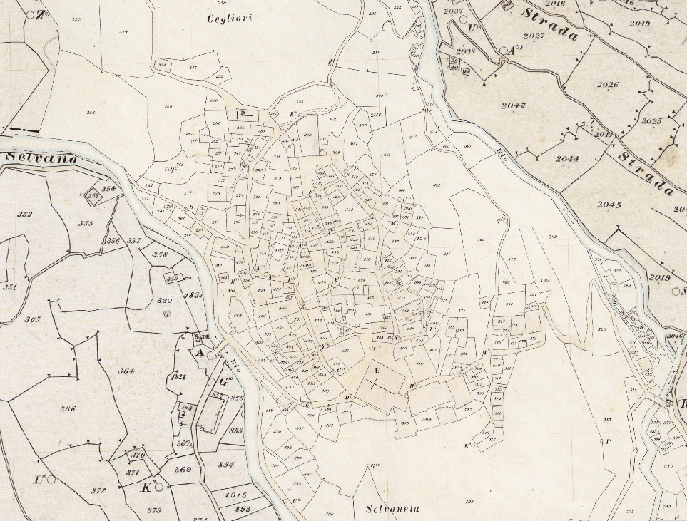
So the landslide was way before that (1700s?? would be my best guess..). And look at the place where the main car park is now. Just a single bridge over the river. Very interesting!
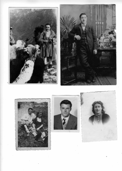
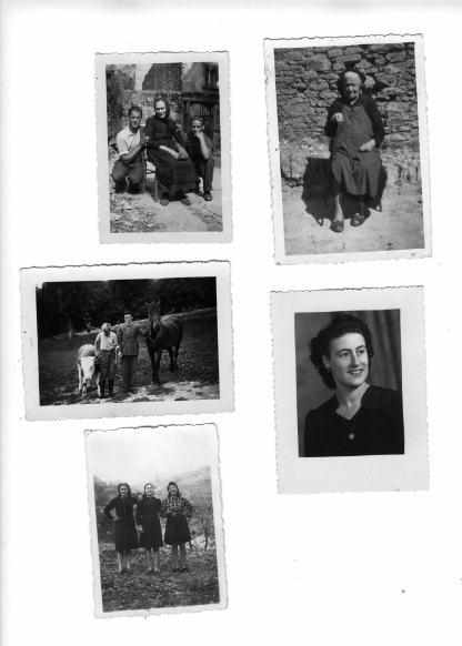
To those of you who know our neighbour Flora, aged 90, here are some black and white pictures from her collection (sadly scanned too small) and, yes, the lovely young woman standing outside the TTI church dooor is her. The girl with the sheep and the fat baby are evacuees during the war. The gentleman whose knee Flora is caressing is her husband Luigi, and there are also various elderly relatives.
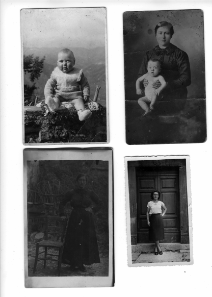
Here is the Doctor (he of the Doctor’s house) in short trousers as a very young man with his father Alberto (who several witnesses have agreed spent a significant amount of time shoring up the roof of part of the secret tunnel, and was probably one of the group that blocked it up).
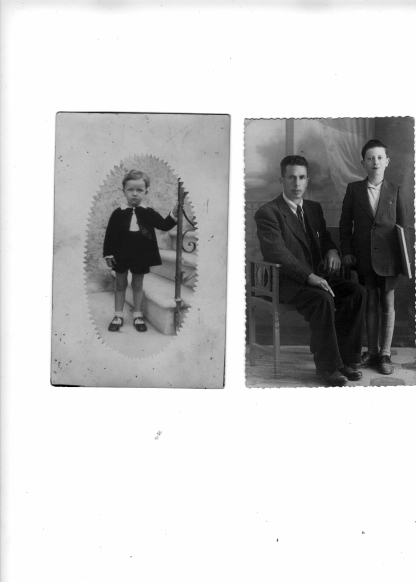
The Doctor sadly passed away just a few weeks ago.. He was a lovely man, and I was very sorry to hear this.
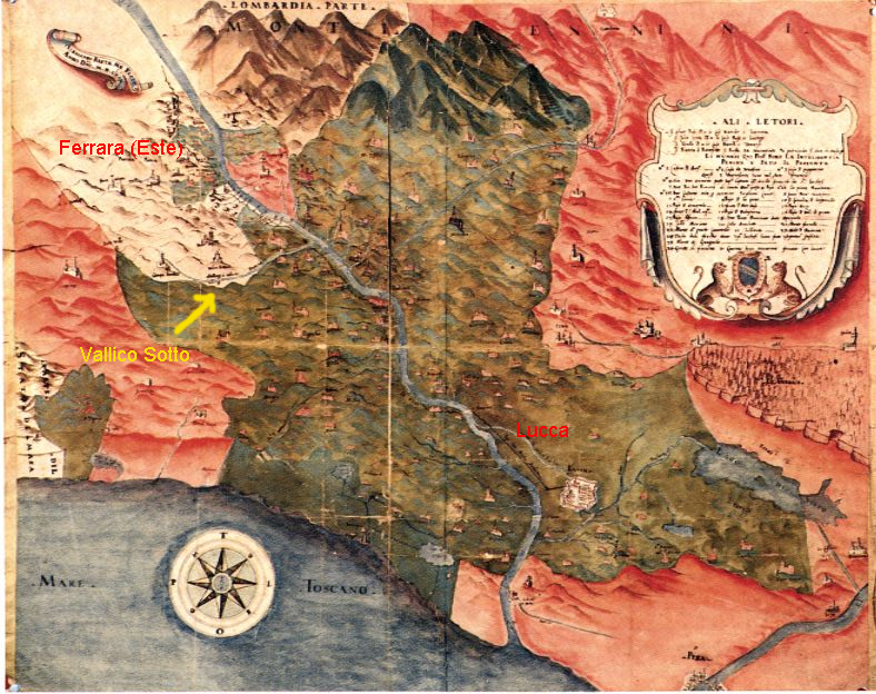
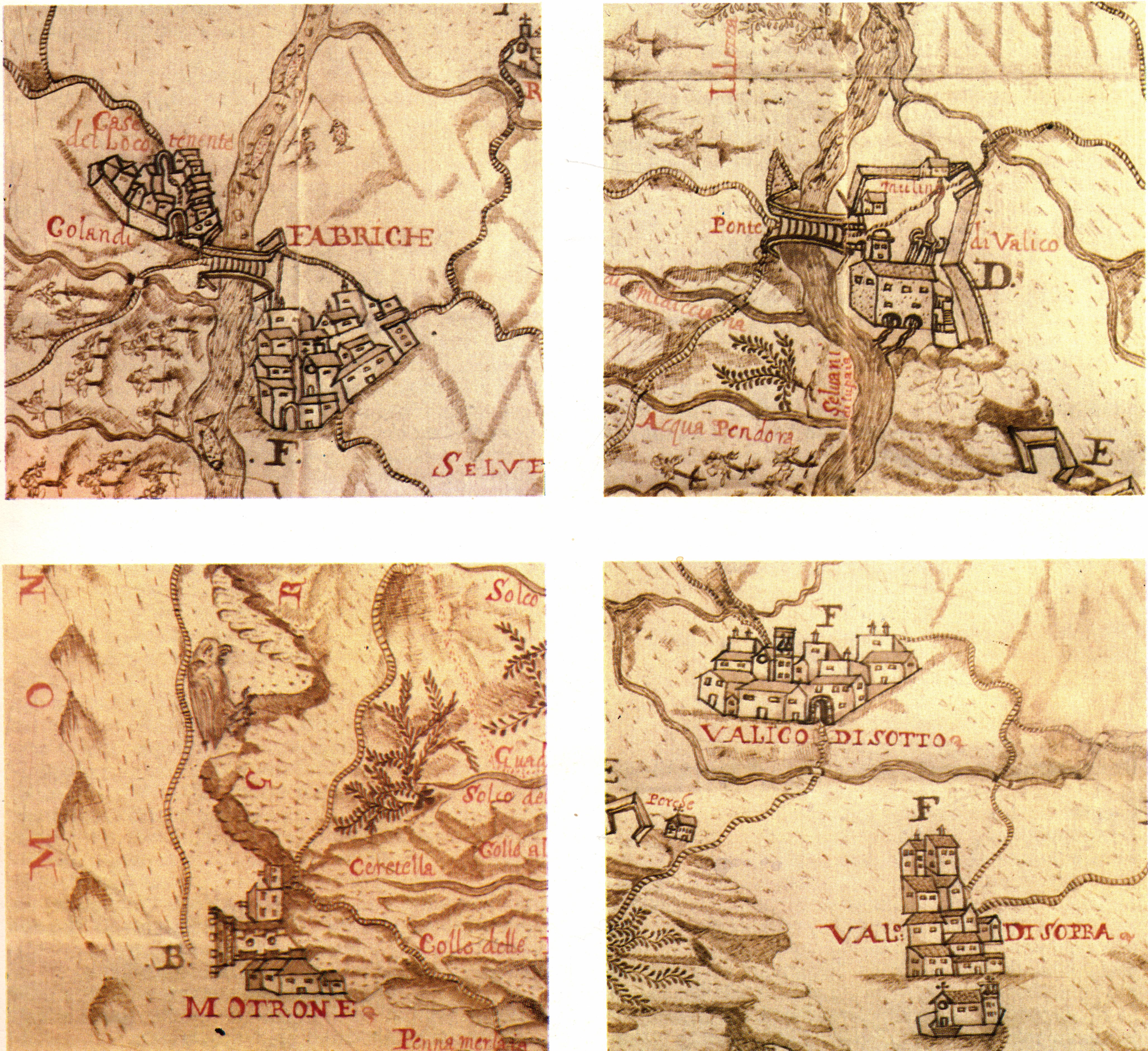
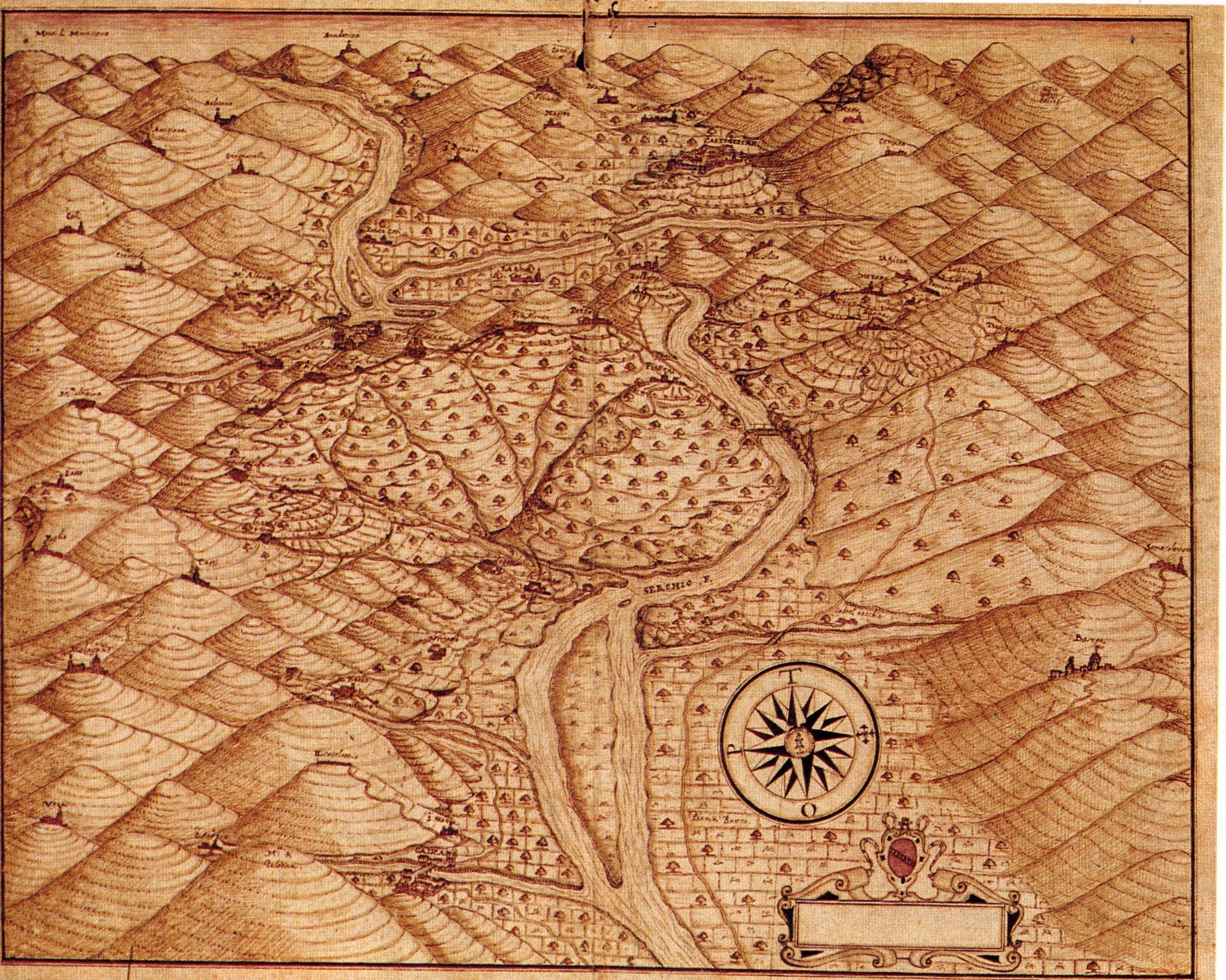
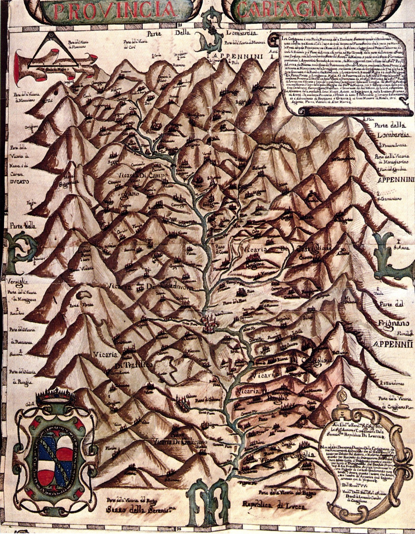
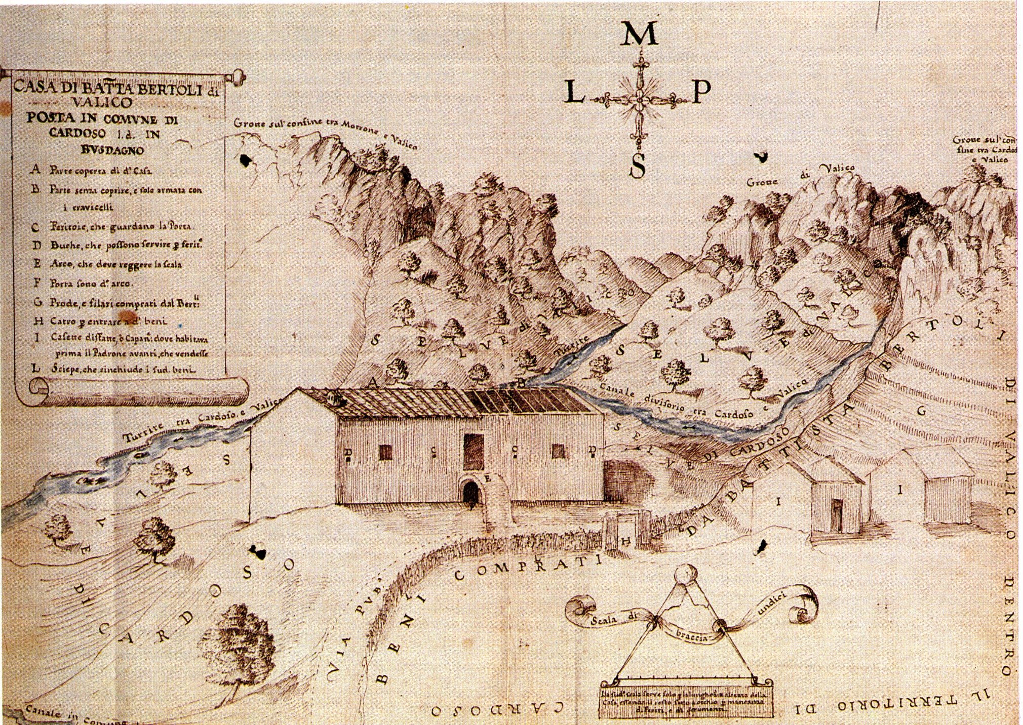
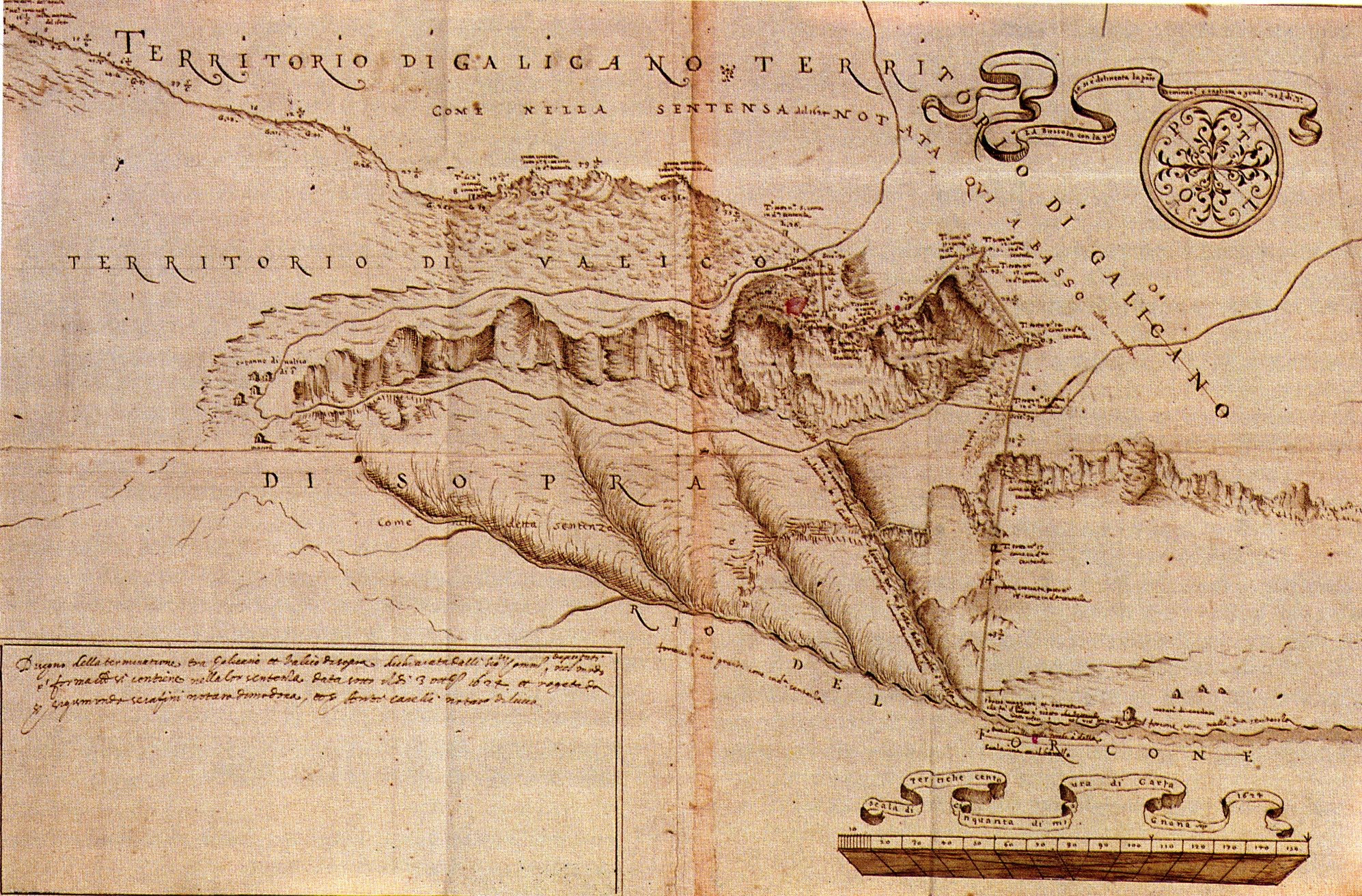
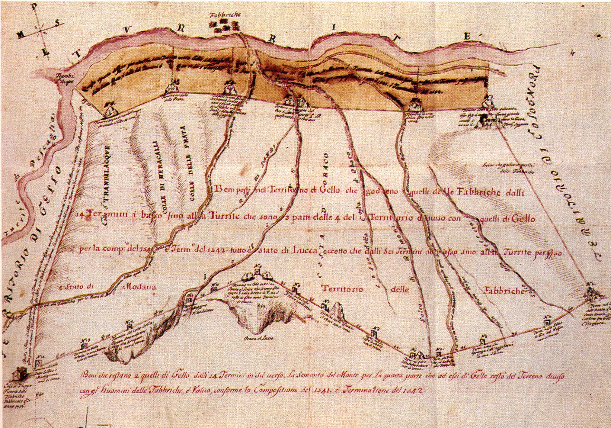
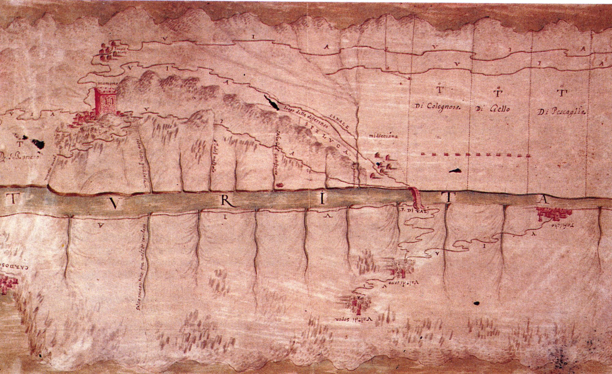
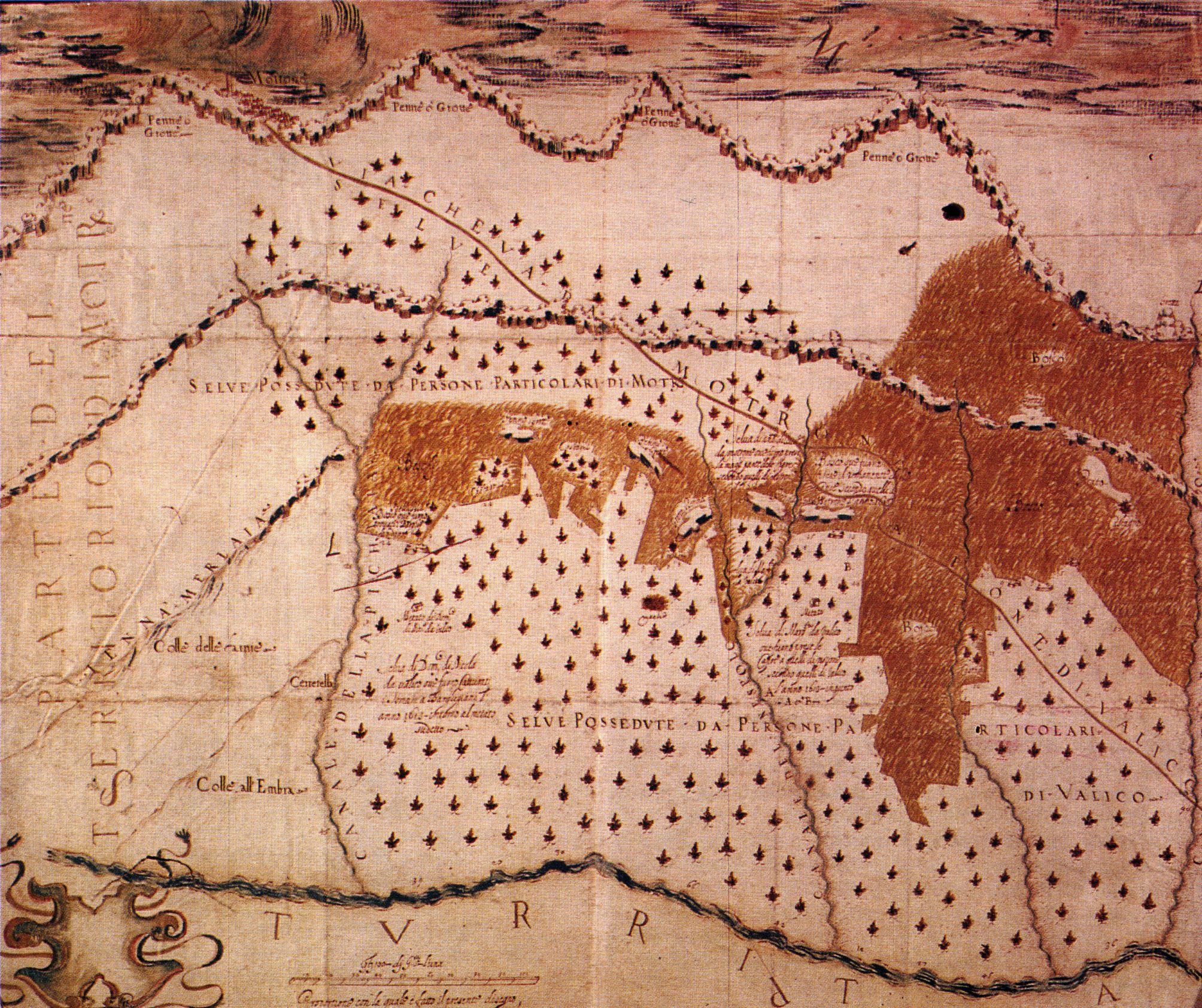
Here are some maps of the village and the surrounding area from long ago (back to medieval times). Remember the city state of Lucca (green in the map below) owned almost all the land south of the river running through Fabbriche di Vallico. Our village of Vallico Sotto was the property and main frontier post of the Dukes of Este in Ferrara (white). The wars between the two were largely about the little white bits on the other side of the river that you can see in the map. Florence owned large (red) amounts of territory as well – see below.
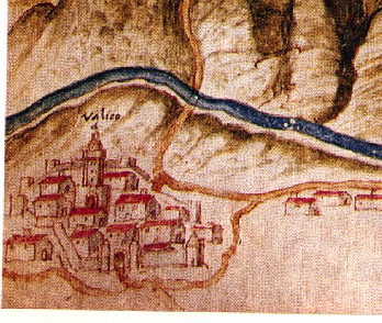
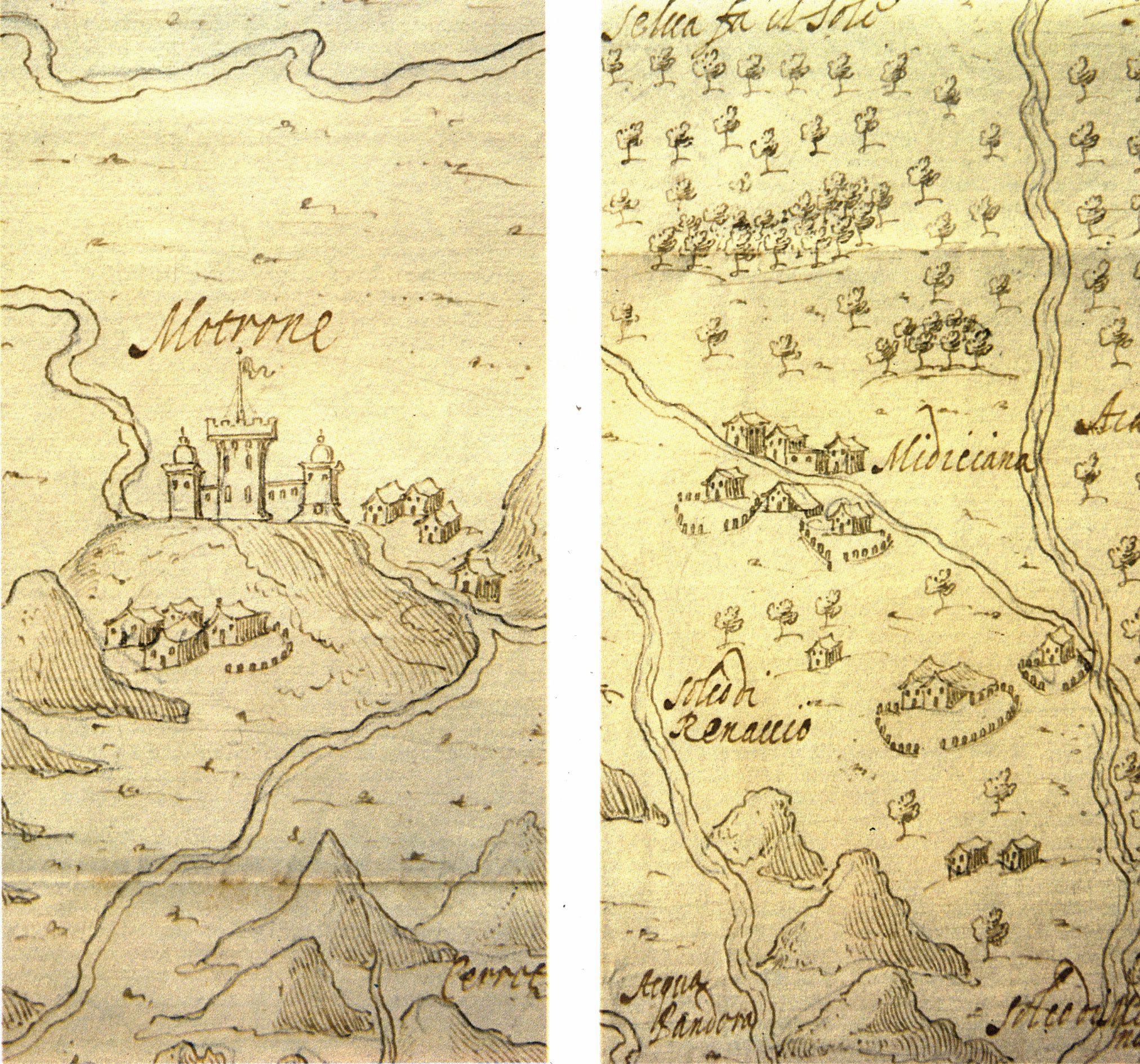
Look – only one l in the 1400s.. and what’s that building on the bottom left outside the wall? Surely not? If this is an even slightly accurate drawing rather then a ‘generic village’ (which of course it might well not be) then that would have to be our very own TTI church.. And what on earth is that giant tower? It’s not the one attached to the current main village church.
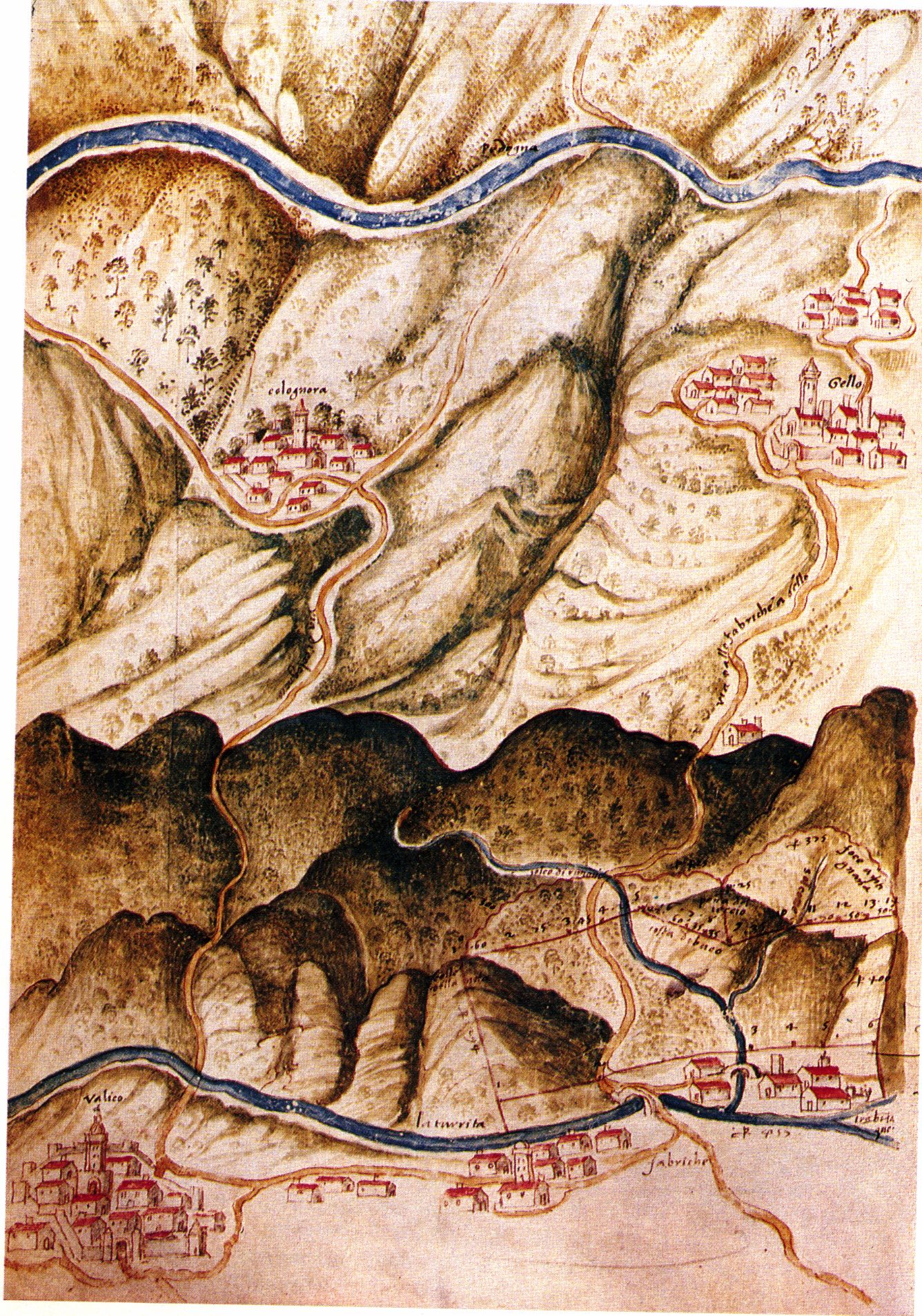
Just look at those fortifications blocking every approach to the Vallicos. They must have been impregnable..


And finally – just for fun – here’s a nice Google+ page of photographs that Jamie and I made in October of the Vallico Sotto church and beautifully maintained cemetery. We did this because an American girl wrote to me asking if I could find out anything about her great-grandmother Amelia Guerra who – having emigrated to America – moved back to Vallico Sotto near the end of her life. We found her. Can you?
https://plus.google.com/photos/106077231740498211633/albums/6077733756049328561
Isn’t it beautiful? What a great place to die..
Update (27th July, 2015)
Given the continuing problems with access to the late Doctor’s House — in whose cellar we know there is an entrance to the secret tunnel — I recently managed to get our friendly geophysicists back up to Vallico to do some more resistivity scans of the terraces above the house. The normal georadar technique has much less depth penetration than the tomography technique that measures the resistivity so the latter seems to be the way to go. If we suppose the tunnel has two entrances (it wouldn’t be much of an escape route if it didn’t!) then this might enable us to find the second one without annoying the inflexible new padrone.
First up, some 2D scans of three terraces (click on the image below to view the PDF). The second one (‘Sezione intermedia‘) is the one you’ve seen before with the ‘blue anomaly’, and we’ve now added two more. The first one (‘Sezione vicino alla casa‘) represents the ‘lowest terrace’ which is not really a terrace at all — in fact it is the path just above Delma’s vegetable garden leading from the TTI church to the ravine. This was not my intention – I wanted them to scan across the Doctor’s lawn to the ravine on a flat course from TTI, but I wasn’t present and they misunderstood my instructions. The third scan (‘Sezione alta‘) is of the terrace about two thirds of the way up the hill. Taken together the three scans seem to show the blue anomaly is a continuous feature stretching up under the terraces, at approximately the same depth under the surface and approximately following the red dotted line.
Is it the tunnel though? Hmmm. I’m not sure. To me it seems that in the lowest scan the blue anomaly is not deep enough. Recall that the path in question where the scan is taken is more than 2 metres in the air – it’s built on top of a wall behind Delma’s garden — and this is why it was not my intention to scan there. Given that is the case, the blue feature would then only be just below the surface of the Doctor’s lawn. From what the old men told me, the tunnel should be at approximately the location of the large red round blob marked ‘700’ a few metres below the blue feature.
Remember also that blue indicates low resistivity (water or saturated soil?) and red means high resistivity (rock or perhaps air?). Given they blocked the lower end of it, it’s entirely possible that the lower section of the tunnel is flooded, but all the way up the hill? Hmmm.. Why can’t the red blob be the tunnel? I asked the georadar guy, and he says:
“I valori di alta resistività rilevati sono comparabili tra di loro. Non esiste un valore di riferimento per una cavità vuota ma comunque dovrebbe essere anomala rispetto a quella riconducibile ai calcari.”
That is, the values of high resistivity of are all comparable, indicating that they’re the same type of thing (i.e. rock). There is no reference value for an empty cavity but it ought to be appear anomalous with respect to the various rock formations.. This is probably a good point, but it’s a 2d section. Maybe we’re sitting directly on top of the wall they build to block it? Clutching at straws, I know, but from human factors it really is absolutely definite that there is a tunnel or an ex-tunnel somewhere in this scan. I suppose this means that one more scan is needed of the Doctor’s lawn itself. Sigh..
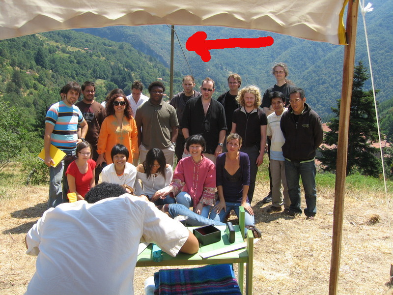
Moving now to higher altitude, I also asked them to do a proper 3D study of the top terrace far above (TTI regulars will recall this as the site of our Bedouin Tent in the early years of our conference and summer school series). . The upper terrace was supposedly the site of an ancient castle whose ruins protruded above the surface within the memory of the grandparents of people still alive today (though I know no-one alive who claims to have seen them..). Can we find the castle? Well, I must say, this looks like one to me:
If you look carefully — particular in the bottom right image of the first of these three PDFs — it seems clear that there is a cylindrical structure which is likely to be the deep foundations of a tower (I’m reliably informed that natural rock formations pretty much don’t do that). The tower is embedded within a linear feature that seems to be the foundations of a huge wall. Good. We seem to have discovered something definite – finally.
Sadly in Tuscany it is illegal for people who aren’t accredited archaeologists to dig with the intention of discovering ancient things. It is legal to dig holes to, say, build a fence and accidentally discover treasure at the bottom of a hole, but it has to be an accident. Hmm…
What to do now? All emailed suggestions will be read with interest..
Update 2 (11th August, 2016)
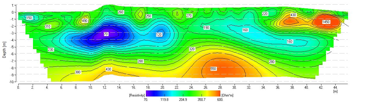
OK – one year later, I get the georadar chaps to come back to do the tomography on the Doctor’s lawn which they didn’t do last year, and lo and behold, if that isn’t a tunnel – exactly where we expected it to be – I’ll eat my shoes.
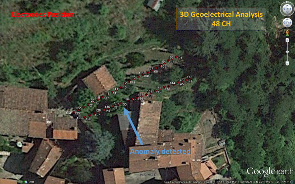

Here’s the full PDFs, first in 3D (click on it, and use the page up and page down arrows):
and then in 2D slices of increasing depth. The tunnel is around 4.5 metres straight down
That’s too deep without access to the cellar of the Doctor’s House. Hmmm..
And, just for completeness, here’s a not very interesting PDF of the TTI back garden:
Maybe the rectangular green feature in the centre of the garden is the grave of the former abbot or something. You never know..